Řeporyje. Where it all begins.
The Church of Saints Peter and Paul overlooks the square. The first nature-trail panel introduces its history. From here, the streets gradually give way to a path along the Dalejský Stream.
Řeporyje → Hlubočepy · Prague 5
Two valleys, old quarries and stone viaducts. Discover the places waiting for you along the Dalejský Stream before you set off.
01 / Through the valleys
From Řeporyjské náměstí through the Dalejské Valley and Holyně into the Prokopské Valley. The original route finishes at Slivenecká 77/1 in Hlubočepy.
Start · Řeporyjské náměstí50.032528 N, 14.312067 E
Finish · Slivenecká 77/1, Hlubočepy50.041211 N, 14.393930 E
The original route is a walking route. The shared link uses hiking mode. If you plan to cycle, use this page as a guide to the places and check cycling access before your ride. The 1 h 52 min estimate excludes stops and the lake detour.
02 / What you’ll see
From a church and an old mill through geological history to a quarry lake and a viaduct. Seven selected stops, in order from the start.
The Church of Saints Peter and Paul overlooks the square. The first nature-trail panel introduces its history. From here, the streets gradually give way to a path along the Dalejský Stream.
The remains of this former roller mill recall the valley’s industrial past. A watermill stood here in the 18th century and was later modernised by the Truneček family. View the ruins from the path.
Tilted layers of limestone preserve the story of a Silurian sea. Known for its fossils, Mušlovka is part of the Dalejský profil National Nature Monument. Pause and read the landscape through its layers of stone.
The quarry face records the transition from the Silurian to the Devonian. The trail panel also introduces sea lilies and their unusual spherical loboliths. A geology stop that brings the rocks to life.
Beyond Holyně, another striking limestone backdrop appears. Červený lom exposes Lower Devonian layers, while its sunny slopes support warmth-loving plants and animals. The area is now part of the Prokopské údolí Nature Reserve.
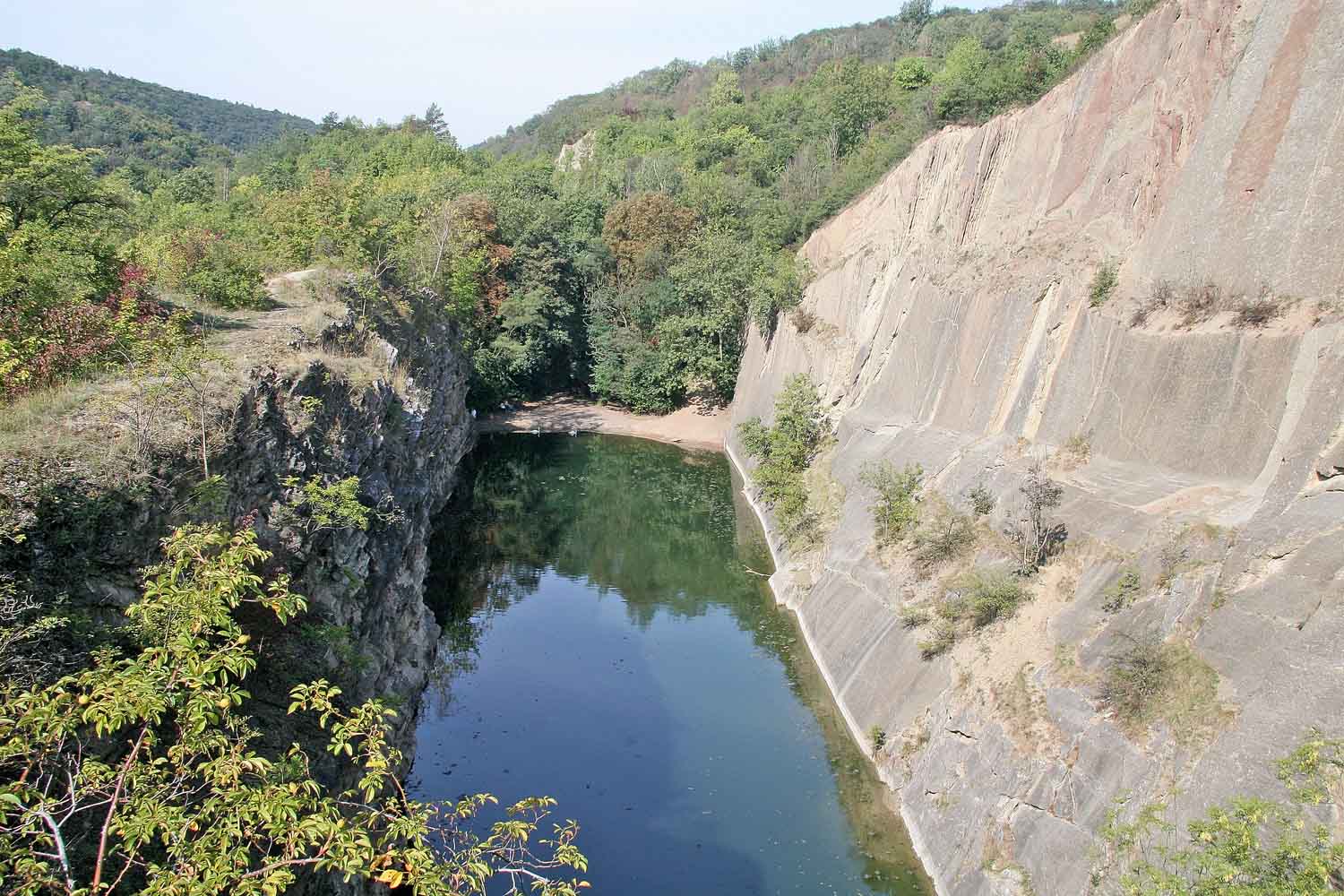
A flooded quarry, a near-vertical rock face and a quiet pocket among the cliffs. Leave the main valley path for a short detour to the lake. The shore is outside the original GPX track: this is an optional extra stop.
The northwestern Hlubočepy Viaduct belongs to the Prague Semmering railway. Its five arches provide an impressive stone backdrop near the end of the walk. Only a short stretch remains to the finish at Slivenecká 77/1.
03 / Food near the finish
Two restaurants for a meal, plus a café for coffee and cake. All are at or close to the finish at Slivenecká 77/1 in Hlubočepy.
Slivenecká 77/1, Hlubočepy
Modern cooking built around seasonal ingredients, with a wine selection and views of the Hlubočepy rock faces. The restaurant is at the route’s finishing address.
Closed on Mondays. Kitchen break: 15:30–17:00.
Slivenecká 50/6, Hlubočepy
A nearby option for Czech classics, soups and a daily lunch menu. Look for the Hlubočepy restaurant on Slivenecká; the same website also lists a separate Smíchov branch.
Table reservations are accepted by phone.
Slivenecká 77/1, Hlubočepy
For a lighter finish, stop for coffee, pastries or cake. This café and cake shop is near the Nádraží Hlubočepy transport stops and shares the route’s finishing address.
Coffee to take away is also available.
Details checked on 11 October 2026 using the linked official websites. The walking distance to U Škopů is an estimate based on the original route and the restaurant’s location. Check current opening hours and menus before your visit.
04 / Before you set off
This is a one-way route from Řeporyje to Hlubočepy. Plan transport to the start and from the finish using current timetables.
The map estimate covers walking only. Add time for photographs, reading the trail panels and taking a break.
The shore lies off the main track. Take the local path to the lake, then return. In the nature reserve, stay on marked paths and follow local restrictions.
05 / Carefully checked
The route comes from the original Mapy.com export. Descriptions are supported by sources, and every photograph has a traceable origin.
Verified on 11 October 2026. The Mapy.com link contains a hiking route from Řeporyjské náměstí to Slivenecká 77/1: 7.1 km and 1 h 52 min. The original GPX export contains 422 points, with a total distance of approximately 7.09 km between them. The interactive map displays this track unchanged.
The selected places were compared with the GPX track and the nature-trail description. Numbers 1–7 belong to this presentation, not the official trail panels. Approximate distances refer to points on the path near each place. The lake is marked as an optional detour; neither its path nor its length has been added to the GPX.
Photographs may show an earlier appearance or a different season. They are not a current record of path access or building condition.
All photographs come from Wikimedia Commons and have open licences. When reusing them, preserve the author credit, source link and licence terms. The page crops images for display; the photographs have not been retouched.
The photographs, text, Leaflet library and GPX are included in the files. An internet connection is needed for map tiles and external sources. Without the basemap, the map still displays the track and stops. Map data © OpenStreetMap contributors; map library Leaflet 1.9.4 (BSD-2-Clause).